What's On
What's On
Where to watch the 2026 World Cup in Manchester
 Danny Jones
The 2026 World Cup is undoubtedly the biggest sporting event happening this year, and for those still wondering where is best to watch it, there are plenty of places in Manchester to make sure you don’t miss a second of the action.
We’re not going to get carried away and declare this as ‘England’s year’, but let’s just say we’ve got a very good squad and a head coach who has won some of the biggest footballing trophies on the planet.
That being said, we have every reason to feel positive, especially with so many great Manc pubs, bars and more screening the World Cup games.
So, let’s not drag this out like a long VAR any check: here are 26 of the best places to watch the 2026 World Cup in Manchester city centre and beyond…
26 top places to watch the World Cup in and around Manchester
1. The Grosvenor – Oxford Road Corridor
Up first on our list is the old Footage pub, which these days has been updated to The Grosvenor. They’re teaming up with Fireball for a big fan zone, including everything from free shots of that famous cinnamon whisky and other giveaways to quizzes, games and more. Grab your tickets now.
ADVERTISEMENT
2. House of Social – First Street
One of Manchester’s biggest and best new food halls and bars, House of Social, is also hosting its first-ever big tournament viewing party, with five big screens being installed. Standard entry is free, while seated (£15) comes with a free drink included and a comfortable view of the action, and VIP (£30) tickets come with £15 to spend on food, too. In addition to pre and post-match parties with live music and even a margarita truck out in the garden section, not to mention the terrace benches with heated canopies, this one is a great package all-around. Tickets are right HERE.


4. The Faraday – Northern Quarter
In at number three, we’ve got The Faraday over in the Northern Quarter (formerly Seven Sins, for anyone unaware), which has all the games you could need – and we don’t just mean the ones up on the telly. They’ve got pool, shuffleboard, darts, and more, not to mention live music throughout the week.
ADVERTISEMENT
5. Boundary at The Union – MMU
Rounding off our top four (the Champions League spots, if you will) is the very impressive space set up by Boundary over at The Union on Manchester Metropolitan University’s campus. Not just for students, this is much more than a uni bar: besides the pub itself, they’ve turned the gig and club room into a huge fan zone, with live DJ sets, super cheap drinks, and even 10p off Carling EVERY time England scores. Say no more; book your spot for the Three Lions games HERE.


6. Definitely Maybe – NQ
Next up, we have Manchester’s dedicated Oasis pub, Definitely Maybe, also over in NQ. You may associate this place more with Britpop and/or pre- and post-gig vibes, but the brilliant Afflecks music bar also has three large screens in the main room, not to mention tables and regular standing tickets available. Food and drinks packages will also be available, and there’s even a Green Room that can host private screenings of up to 60 guests. Reserve your spot now.
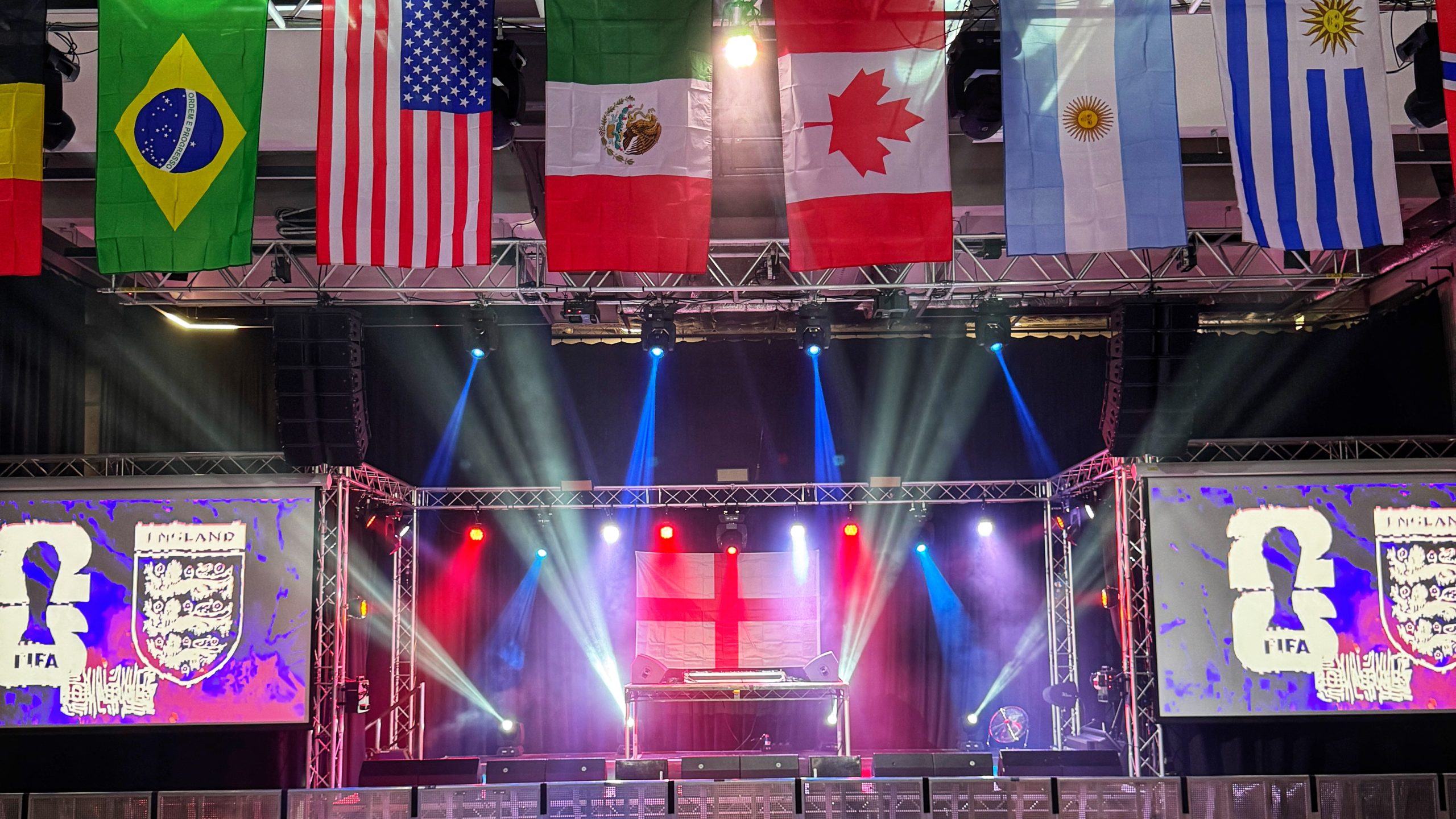
7. Road to Victory – AO Arena
Number six is, of course, the now-famous Road to Victory, which returns for every big international competition. Having been at multiple places before landing at Manchester’s AO Arena, it’s now a bigger party than ever, with smoke machines, confetti cannons, giveaways, and interactive stuff for supporters to fill the break, just to name a few highlights. As close to being in the stadium itself as most will get this June and July – sign up HERE.
8. Victoria Baths – Chorlton-on-Medlock
From Road to Victory (RtV) to ‘Victory at the Baths’, over Chorlton way, is also holding a big fan zone for the latest international tournament. We don’t need to tell you how stunning a space this will be to watch ‘the beautiful game’, but it will also have some of the best acoustics in the business when those goals go in, the limbs go up, and the pints are sent flying. Find out more and grab your tickets while you can.
9. Freight Island – Mayfield
Similarly, their old neighbours at Depot Mayfield are bringing back their own building-wide watchalong party, ‘We Are Football Festival’. Operating in partnership with 4TheFans, the fan park specialists return for World Cup 2026, with several big rooms to be made the most of. You can find out all you need to know down below.
10. Zouk – Oxford Road
One entry on the list that may surprise you is Zouk Tea Bar and Grill over at The Quadrangle, just off Oxford Rd. Now, it goes without saying that there’ll be some unreal Indian and Pakistani scran being served up here over the summer, as there is every single day, but they’re also putting up big screens for select games over the next month or so. Book your table with food starting from £29 per person HERE.
11. St John’s
Now, we thought we’d lump a few of these into one, because St John’s – just off Deansgate and behind Spinningfields – is gradually becoming one of the fastest-growing districts in central Manchester city centre, not least of all thanks to the brilliant food and drink scene over in this small slice of the city. With Trading Route, Courts Club, Stables Tavern and now ‘The Green’ all helping create a great atmosphere ahead of this year’s sporting summer, food, drink, and pure vibes will be in full flow.
12. O’Malleys – Central
Heading over to O’Malleys on Portland Street, right in the heart of the city centre, we may be bursting with some great Irish bars and pubs in Manchester at the moment, but O’Malleys MCR undoubtedly has some of the cheapest pints and value for money across the board. They’re doing free entry throughout, and they’re showing every single game, so you don’t just have to be backing British teams.
13. Hotel Football – Stretford
Heading toward the outskirts for a spell, Hotel Football, which sits in the shadow of Old Trafford, is obviously a footy-obsessed venue from start to finish, but this isn’t just limited to Man United affairs. This World Cup, they’re showing every England game and even offering special stay-overs, with dinner, as well as bed and breakfast included. Find all the options HERE.

14. GRUB On The Docks – Salford Quays
As we cross the halfway point, and since we’ve strayed just beyond the city centre, we thought we’d shout out the fantastic festival feel being set up for GRUB On The Docks over at MediaCityUK. Formerly known as BOX on the Docks, this new-look outdoor leisure and live entertainment hub will hopefully serve as the perfect suntrap, not to mention there’ll be plenty of boxes showing the football itself.
15. Nell’s – Various
Any place offering free fan zones gets a big thumbs up from us, and fortunately, we already know plenty of people heading back to Nell’s for World Cup watchalongs. Nell’s Pizza and frozen cocktails speak for themselves, but in case you weren’t aware, they have a big projector up at their Kampus location, as well as screens at their other sites, such as Common, The Beagle, and over in Salford Quays, too
16. Blues Kitchen – Deansgate
The Manchester Blues Kitchen site just off Deansgate is another one that we can vouch for when it comes not only to watching the biggest sporting fixtures, having watched the Super Bowl there every year for the past half a decade, but also the footy – in fact, we watched the last Euros final in there and while the result was gutting, the night overall was excellent. It’s first-come, first-served, and their latest Southern-inspired food menu feels like the perfect fit for the North American tournament.


17. Society – Central
Another food and beer hall, Society, is another ideal spot to watch the World Cup in Manchester this summer. Not only do you have rows and rows of tables and benches to seat fans, multiple kitchens to choose from, and a great selection of locally-brewed bevs, but you’ve also got the outside area to hopefully soak up sun, suds, and energy from the crowd during the breaks. Hopefully, we’ll be at least 1-0 up in most matches by the time the whistle blows for half-time.
ADVERTISEMENT
18. Joshua Brooks – Central
Beloved Manc bar and nightclub ‘JBs’ is bringing their dedicated England fan zone back for the 2026 FIFA World Cup, and if you spent any time during the last edition, you’ll know the atmosphere in here is great. Complete with shiny new booths, multiple screens, a DJ booth and more, the ‘Clubhouse’ upstairs is well worth a go for a game or two. Find ticket prices and all their other events listed HERE.


19. The Lawn Club – Spinningfields
Heading back over towards Spinningfields direction, Lawn Club on Hardman Square is another great alternative for World Cup screenings, especially as you’ve got the indoor hut, complete with cocktail deals, AND the roomy beer garden outside. For those who haven’t stumbled across it before, here’s a better idea of how it’s going to look based on previous years:
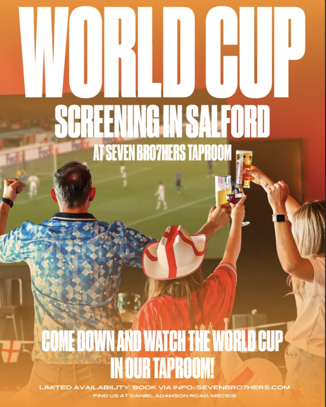
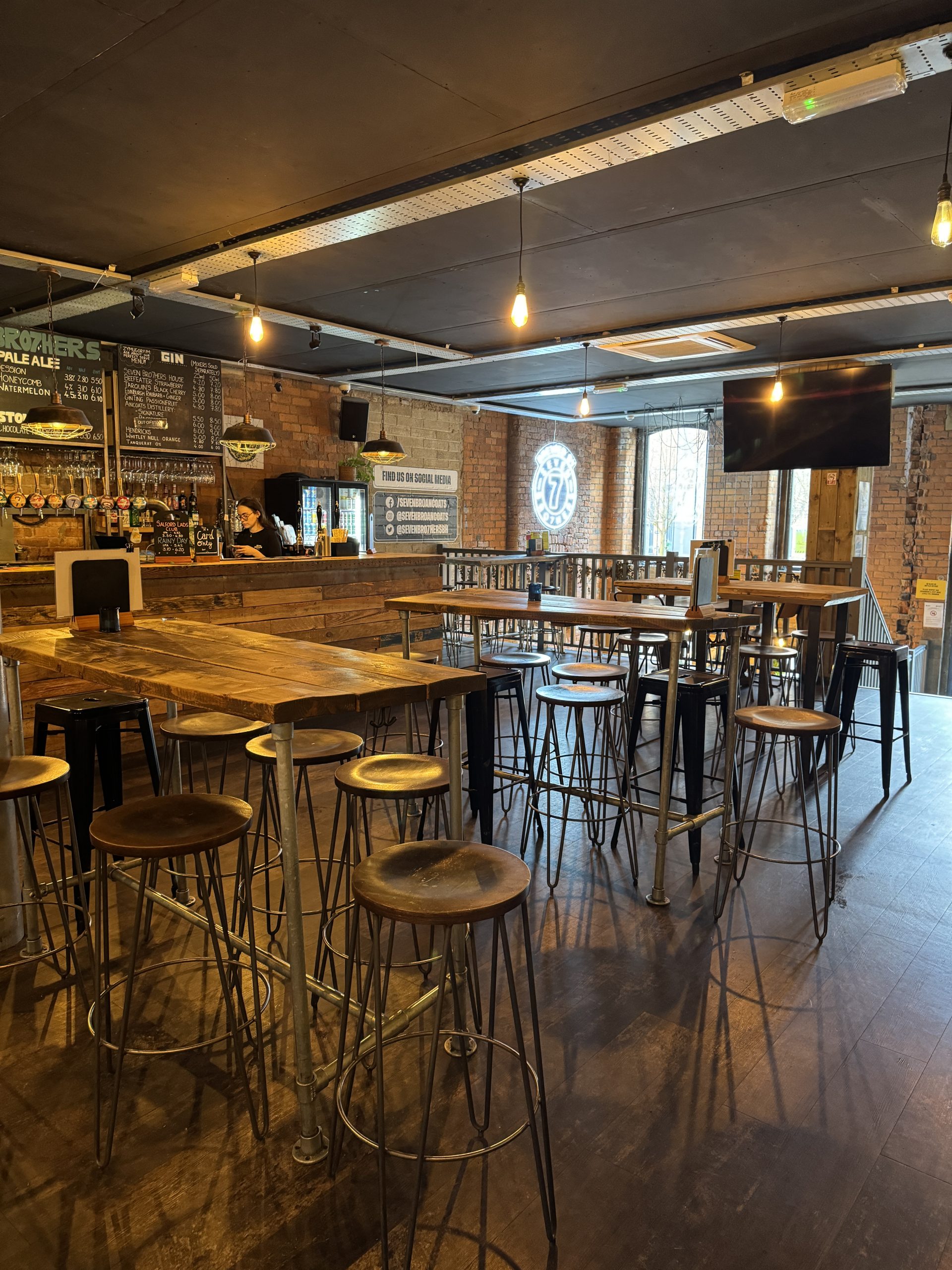
20. Seven Brothers – Ancoats and Salford
Holding viewing parties for the 2026 World Cup at their two flagship homes – the taproom and their first-ever beerhouse, Seven Brothers are also offering bookings, from just you and your partner, to big private hire for groups of mates and work colleagues. Spaces for England’s first game against Croatia on Wednesday, 17 June, are already filling up, so email either venue to reserve your spot ASAP.
21. 11 Central – Salford Quays
Speaking of the Seven Bros Brewing Co., another one of their brands over at Quayside in MediaCity is another place that will be showing all England games, at the very least, throughout the 2026 World Cup. This still relatively new Salford Quays spot may go overlooked in foodie terms at times because of Central Bay next door, but one thing they do better than their neighbours is live sport on the box.
22. Black Cat Club – Central
No. 22 is the brilliant Black Cat Club, brought to you by the same team behind the Michelin-recommended El Gato Negro and Canto tapas restaurants on King Street and Cutting Room Square, respectively. To toast this year’s tournament and the last time England won the World Cup, they’re serving up a ‘Geoff Hirst’ deal, where you can grab three small plates for £19.66, or four-pint pitchers of Black Cat Lager, Red Stripe or Moretti for the same price. Here are all of their packages.
ADVERTISEMENT

23. Dirty O’Sullivans – Albert Square
From Mediterranean influences to more Gaelic goodness, another recently opened Manc Irish bar is also offering great deals for this year’s World Cup, including giving away 1,000 FREE pints to those who pre-book their table at this increasingly popular pub just off the corner of Albert Square. Sort yours HERE.


24. Electric Shuffle – Central
As we approach the final minutes of this round-up, if you will, we thought we’d throw in another favourite gaming and activity bar of ours in the form of Electric Shuffle. You can pay either £25 or £50 as a deposit, redeemable off your bill at the end when putting your name down, and you don’t have to book. a shuffleboard table to be in the room – though why wouldn’t you? Bookings are live now.
25. Diecast – Piccadilly East
Our penultimate pick of the bunch, we couldn’t complete this squad selection without giving a nod to Diecast over towards Back Piccadilly and the edge of Ancoats. A previous RtV host, this massive Manchester drinking hall, beer garden, gig and club venue is still well-equipped to hold a big World Cup watch party all of its own. Although all early bird tickets have already sold out, general admission is still on sale for just a tenner, so don’t wait around.
26. Albert Hall – Peter Street
If we’re in extra time, we can’t think of many better places that stressful eleventh hour than Manchester’s iconic Albert Hall; in fact, we have done almost exactly that for the 2022 World Cup and Euro 2024, and we promise you we made some unforgettable memories in here no matter how it all ended. They’re keeping things simple here: £5 entry, and the first 100 get a free pint – tickets can be found HERE.
Read more:
- ICC Women’s T20 World Cup 2026 – all you need to know before it comes to Manchester
- Stockport’s dedicated live music festival for people with complex needs is back for 2026
- Enzo Maresca to Man City: Ex-Chelsea coach looks set to replace Pep Guardiola
For all the latest news, events and goings on in Greater Manchester, subscribe to The Manc newsletter HERE
Featured Images — The Manc Group
What's On
The best things to do in Greater Manchester this week | 8 – 14 June 2026
Emily Sergeant
It’s been a busy few weeks for our region, and it won’t be slowing down any time soon.
Now that June is well underway and summer is right around the corner, that means there’s obviously loads of events and activities to be getting up to across Greater Manchester this week – with all sorts on the lineup, including the start of the 2026 FIFA World Cup.
Finding it a bit tricky to pick what to do though? No worries. We’ve chosen a few of the highlights for another edition of our ‘what’s on‘ guide.
Both free things and those that’ll set you back a few pennies are featured.
___
The Future Is Ours 2026
Manchester City Centre
Monday 8 – 19 June
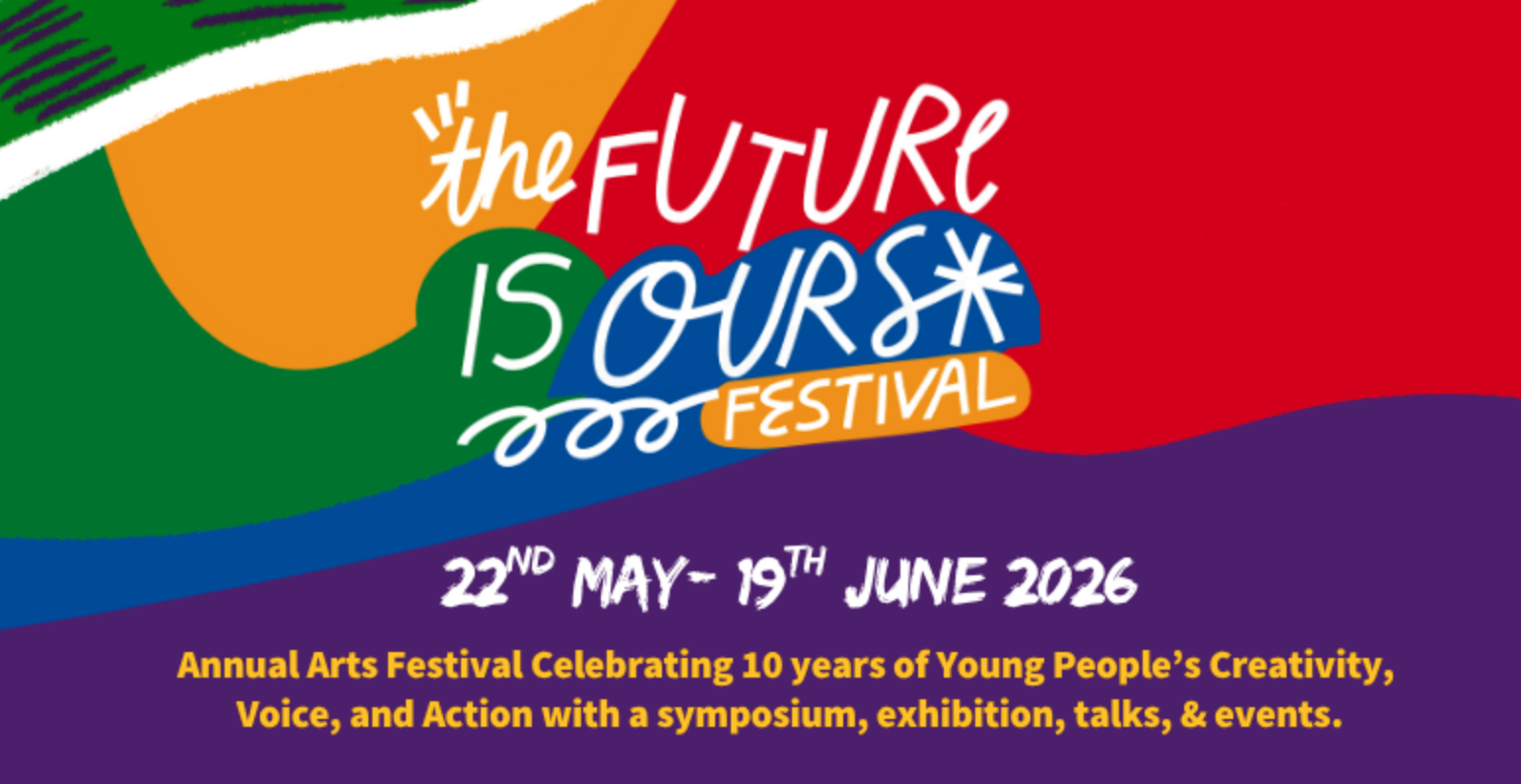

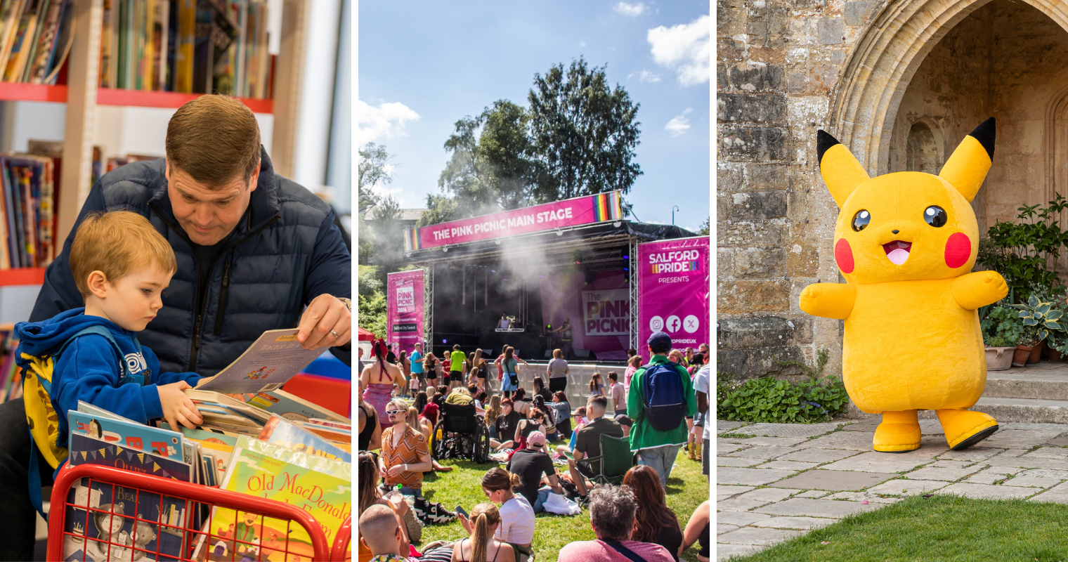
The annual Future is Ours festival is back, and it’s set to be a celebration of youth creativity centred around the importance of creativity as a transformative tool for supporting mental health and wellbeing.
Delivered by mental health charity, 42nd Street through their dedicated creative space The Horsfall, The Future Is Ours is a unique arts festival amplifying and celebrating young people’s creativity, voice, actions, and ideas.
Putting young artists at the forefront of the work, allowing them to say and create what they want in the way they want.
Find out more about this year’s festival here.
___
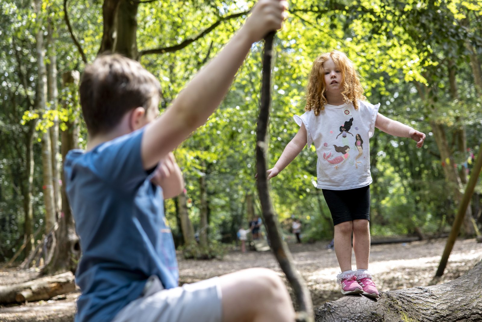
Forest Tubing
Zip World Manchester
Monday 8 June – onwards

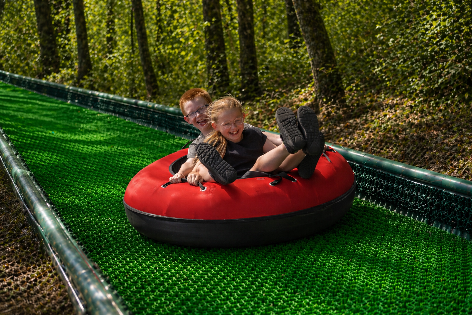
Thrill seekers, this one’s for you – as Zip World Manchester has launched its new Forest Tubing experience, and it’s bringing the UK’s longest outdoor tubing slide is coming to Heaton Park.
The new family‑friendly outdoor adventure gives visitors the chance to soar along two slides, winding through woodland at one of the largest parks in the North West.
Suitable for children aged four and above, visitors can book an hour-long session – with unlimited rides during that time slot – and either ride solo, or share the experience with fellow adventurers.
Find out more and book your tickets here.
___
National Trust x Pokémon TCG Mega Evolution Trails
North West
Monday 8 June – onwards
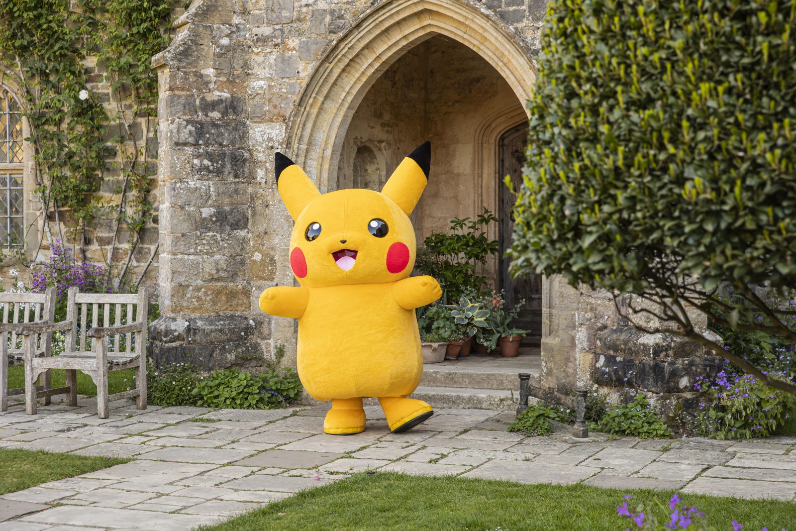
National Trust and Pokémon have teamed up for an exclusive trading card game and immersive trail.
The partnership is set to bring together the places the National Trust cares for and Pokémon’s spirit of play and discovery.
Exclusively designed for the National Trust, the Pokémon TCG Mega Evolution Trails are going to be running throughout summer at 14 National Trust places nationwide, combining ‘imaginative play’ with ‘gentle physical activity’ inspired by Mega Evolution Pokémon.
Find out where to get involved and book tickets here.
___
NEW OPENING – Cat Cafe Manchester
Barton Arcade


Cat Cafe Manchester has officially opened the doors to its new home.
You may remember that the beloved venue in the Northern Quarter – which first opened all the way back in 2016 – sadly had to close in 2021 following unavoidable economic struggles brought about by the pandemic.
But now they’re back, the fluffy felines are back inside Barton Arcade, off Deansgate, and they’re cuter than ever… you can absolutely take our word for it.
ADVERTISEMENT
From Maine Coons Ottie and Heathcliff, and fluffy sisters Yumi and Yoki, to Uno the adventurous Bengal, beautiful Gracie the Ragdoll, and Emerson the proud British Shorthair, it’s clear to see that all 12 residents have been making themselves at home.
Find out more about this exciting new opening and book your visit here.
___
NEW OPENING – The Pigeon
Piccadilly East
Say hello to The Pigeon – the newest addition to the Beermuda triangle in Manchester’s Piccadilly East neighbourhood.
ADVERTISEMENT
Pigeon is fully prepared for summer – with an outdoor terrace, Nell’s pizza available to order and a screen for the World Cup. They’re even treating us to 1,000 free pints to celebrate their launch this week.
With a carefully selected, constantly rotating, range of world-class craft beer, as well as a cracking selection of fine wines, it’s definitely going to be one of our new favourite boozers.
___
NEW OPENING – Fjord
Saddleworth
It’s not every day you come across a sandwich with 20 different elements inside.
ADVERTISEMENT
Tucked above a barbershop in Saddleworth is Fjord, where owner Kieran is taking his meticulous Michelin training and applying it to the humble butty.
He’s spending hours confiting, infusing, distilling, and preparing fillings to go inside Fjord’s signature pan-fried puffball focaccia (which they think might actually be a new invention). There’s also spritzes, brunches, small plates and so much more – Saddleworth’s got a great new addition.
Find out more about this new opening here.
___
Horrible Science: Cosmic Chaos
Science and Industry Museum
ADVERTISEMENT
Monday 8 June – onwards
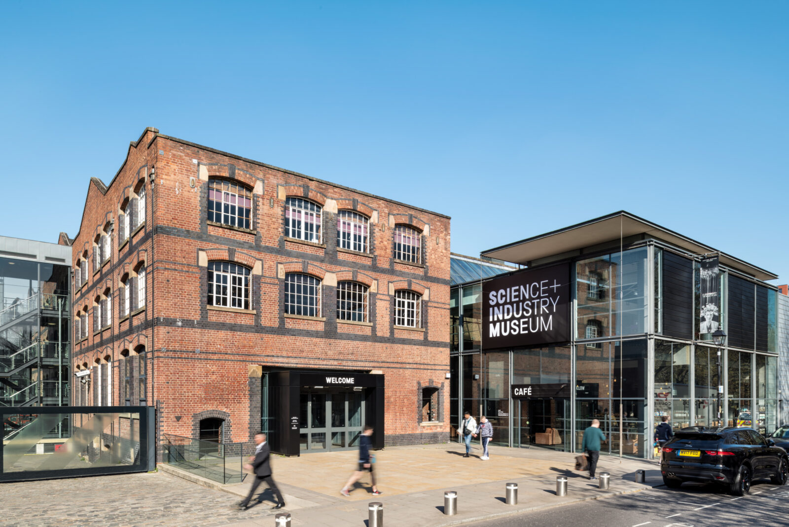
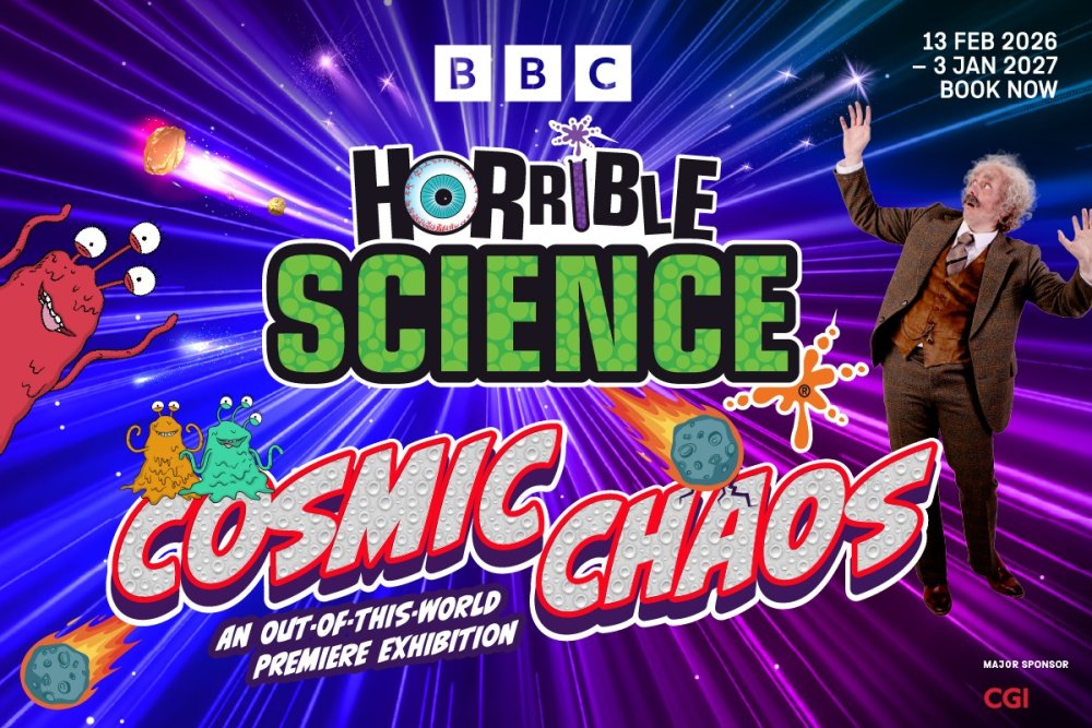
Horrible Science: Cosmic Chaos has made its world premiere at the Science and Industry Museum, and is inviting visitors to explore our wondrous Solar System.
Fresh off-the-back of the new BBC Children’s and Education TV show, Horrible Science, the ‘thrilling’ new exhibition encouraging visitors to ‘do science the horrible way’, and join both scientists and supervillains to unveil the secrets of space.
The new exhibition propels families up into space where mystery, intrigue, and rocket-loads of silly and surprising science await. You’ll get to venture through a series of cosmic zones, walk in the shoes of astronauts, explore the life-giving energy of the sun, marvel at mysterious moons, and discover far-off weird worlds.
Find out more and book your tickets here.
ADVERTISEMENT
___
Salford 100
Salford
Monday 8 June – onwards
Salford is celebrating 100 years of being its own city this year, and a raft of exciting new events have been announced to mark the occasion, featuring everything from art commissions to community events from the likes of Walk the Plank and From The Other – with many free to attend.
Salford City Council has put together the cultural programme across Salford’s eight neighbourhoods, supported using public funding by Arts Council England.
ADVERTISEMENT
Everything has been created to explore the past, celebrate the present, and imagine the future of Salford.
Find out everything happening for this special centenary year here.
___
GRUB On The Docks
MediaCity
Tuesday 9 June – onwards
ADVERTISEMENT

GRUB On The Docks has returned for the summer.
MediaCity’s waterfront site has been transformed into a vibrant open-air destination built for warm weather and big moments across the season, as GRUB On The Docks returns later this week.
Running across the summer months, you can expect some of Greater Manchester’s best street food traders to be serving up global flavours and summer-ready drinks, alongside live music, DJs, and just an all round laid-back atmosphere turning daytime hangouts into evening sessions.
Find out more here.
___
ADVERTISEMENT
Festival of Libraries 2026
Greater Manchester
Wednesday 10 – Sunday 14 June


A huge literary festival with dozens of free events is returning to libraries across Greater Manchester this week.
Festival of Libraries, the county-wide celebration of all 133 libraries throughout Greater Manchester, is back by popular demand this summer, and organisers have now announced a programme filled with free family-friendly events – with everything from games and performances, to exhibitions, workshops, and arts and crafts on the lineup.
Families are invited to explore the different ways of engaging with the region’s libraries, and everything you need to know about the festival is here.
___
Salford Pride’s Pink Picnic 2026
Peel Park
Saturday 13 June
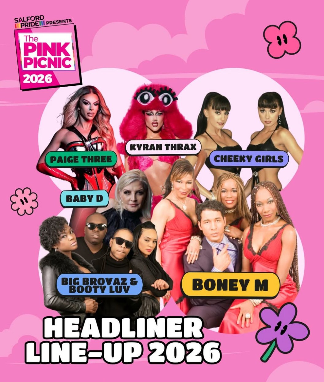

Boney M, The Cheeky Girls, and Ru Paul’s Drag Race UK stars are all on the lineup at Salford Pride’s popular Pink Picnic this weekend.
As this summer marks 15 years of Pride in Salford, Salford Pride has announced a whole host of exciting events to celebrate – including the return of The Pink Picnic, its biggest family-friendly celebration yet, with headliners like 90s and 00s music icons, community talent, and even a ‘bigger and bolder’ Youth Zone for 2026.
Returning to Peel Park once again, The Pink Picnic brings together LGBTQ+ community, allies, families and friends for a day built around community, joy, and belonging.
Find out more here.
___
Did you know that Printworks is currently hosting a UK-wide art competition for students?
Do you know an aspiring artist? Students aged 16 and over are invited to bring the ocean to life in a brand-new creative arts competition launched by one of the UK’s leading entertainment destinations, Manchester’s Printworks.
The venue has now opened entries for UK students from sixth forms, colleges, universities, and art colleges across the country to take part in an exciting new art competition.
The winning design is set to be showcased on Europe’s largest digital ceiling.
Read the full story and enter here👇
___
Did you know there’s an adorable open farm in Bolton where you can meet and hold baby bunnies, lambs, chicks, AND more?
This is Smithills Open Farm, and it’s one of the most wholesome family days out.
Here on this picturesque family-run farm nestled within 70-acres of countryside, you can feed the sheep and llamas, ride a tractor to visit the donkeys, or even head into the barn to see the cows, horses, and piglets.
Plus, they host ‘Pets Corner’ sessions throughout the day too, where you can meet and hold many different baby animals (including the softest little goats and chicks we ever did see.)
They even have a farm shop and ice creamery where you can buy local honey and other goods to take home with you.
Find out more about the farm and plan your trip here.
___
Or what about that Chester Zoo has been named the UK’s best zoo for the third year in a row?


That’s right – the UK’s biggest charity zoo has officially been named the best zoo in the country by TripAdvisor reviews, with the zoo having claimed a record 11,666 ‘excellent’ ratings for the first time too, making it even more of a cause for celebration.
Not only has the zoo’s strong focus on conservation and unforgettable visitor experiences made it the best in our country, but this has also earned it a place among Europe’s elite.
Chester Zoo’s CEO, Jamie Christon, says he is ‘over the moon’ with the zoo’s new title.
Read more here.
___
Fancy saving up to 50% off at some of Manchester’s top restaurants?
A bit of a daft question really, we know… of course you do.
Well thankfully, EatClub – the free app that’s easy to download, and you can start using right away – has now arrived in Manchester, and there are discounts such as up to 35% off Habbibi, Lina Stores, and Salvi’s to take advantage of, plus many more to explore.
Simply download the app, book your walk-in slot, and enjoy. You don’t have to tell the restaurant either – just pay using your EatClub card, and it’ll sort the discount for you.
Find out more here.
___
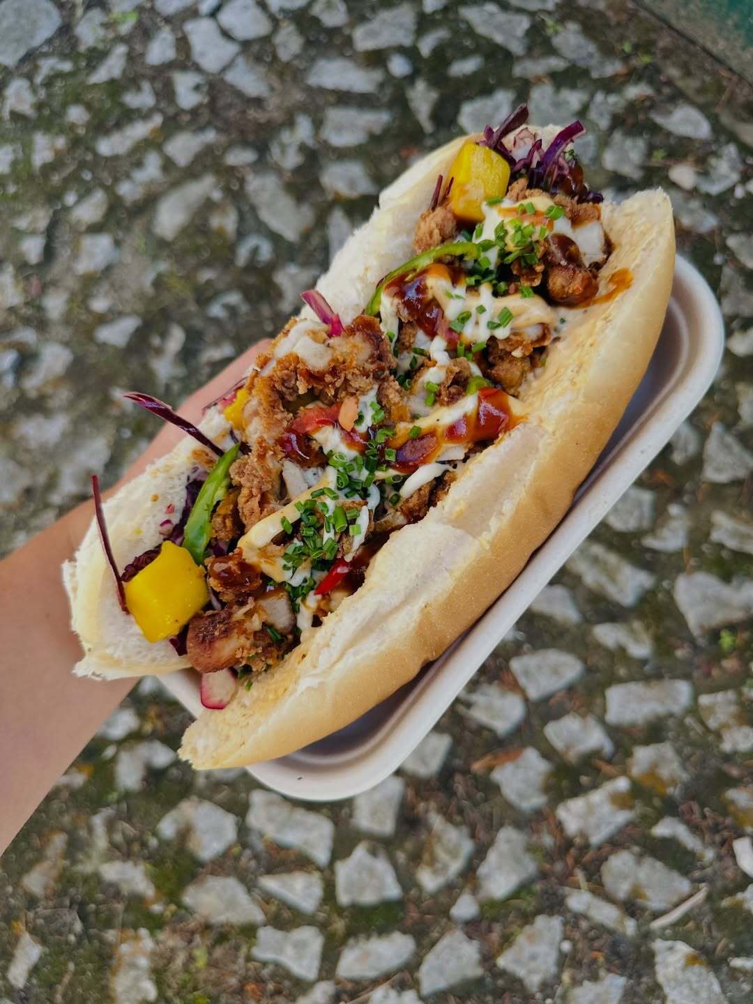
Stuck for somewhere to have a bite to eat?
Just like we do every month, we’ve rounded up some of the best things we got to eat in May, so if you’re on the hunt for somewhere new to eat in June, then we’ve absolutely got you covered as there’s plenty of places across the city region.
It’s been another jam-packed month of insanely delicious eats, and we’ve been lucky to have a bunch of new openings too.
Take your pick here👇
___
Featured Image – Supplied | Salford Pride | National Trust
More What's On


Audio
Clint Boon takes us around Manchester's iconic Deaf Institute


Eats