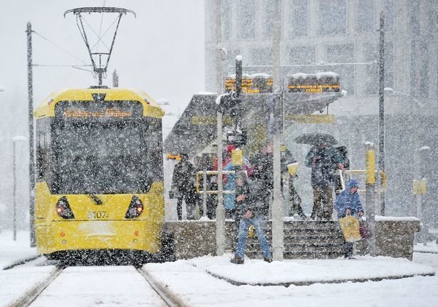
Snow is set to hit the UK over the next few days, with first sprinkling forecast to fall in Greater Manchester this evening.
Parts of North Yorkshire awoke this morning to find a thick blanket covering the region in its first heavy snow fall of the month, and the Met Office is forecasting that this will be making its way south to us here in Greater Manchester from as early as 4pm GMT.
Although flurries are likely to be isolated to the higher ground across the region, the majority of Greater Manchester is expected to feel considerably more chilly.
A minimum temperature of -1°C is forecast.
ADVERTISEMENT
The Met Office has declared that travel disruption is likely due to snow fall – mainly over the hills – and some roads and railways also stand to be affected, with longer journey times by road, bus and train services to be expected.
The weather warning is in place for the region until 9am GMT on Friday 4th December.
ADVERTISEMENT
Unsplash
BBC Weather is also predicting that the first flecks of snow will begin to fall in Oldham at around 4pm today, Rochdale at 7pm, and Manchester and Bolton at around 9pm tonight.
Elsewhere in the UK, there are warnings in place for ice and snow.
We are anticipated to see brighter weather and even some sunshine this weekend however, with temperatures going into next week expected to be lower than the average annual temperature for this time of year.
ADVERTISEMENT
Speaking on the wintery weather, Dan Suri – Chief Meteorologist at the Met Office – said: “It’ll certainly feel more wintry this week, with colder weather bringing a risk of frost, ice and wintry showers. The risk of snow accumulating is largely confined to the northern half of the UK – mainly over higher ground in Scotland, Wales and northern England.
“By Thursday morning, parts of north west Scotland could see 2cm of snow accumulations to low levels, with 2-5cm above 200m and up to 10cm gathering over the highest routes, leading to some travel disruption.”
⚠️ Yellow Warning issued ⚠️
Snow across parts of Northern England ❄️ Valid from now until 0900 Friday
Dan Harris – Deputy Chief Meteorologist at the Met Office – added that despite the cold and unsettled weather, which could include freezing fog, all was not “doom and gloom”. He said: “We’re keeping an eye on other areas where there is potential for disruptive snow, in particular central and south east England, and the hills of northern England,
“It’ll stay cold into the weekend with rain, showers and hill snow continuing across many areas, along with overnight frosts.
“We could also see some stubborn areas of freezing fog develop more widely, which at this time of year can persist all day, however, it’s not all doom and gloom, as there’s likely to be an increased chance of dry, bright, and perhaps even sunny weather on offer as the weekend progresses.”
You can find more information and forecasts via the Met Office website here.
Trending
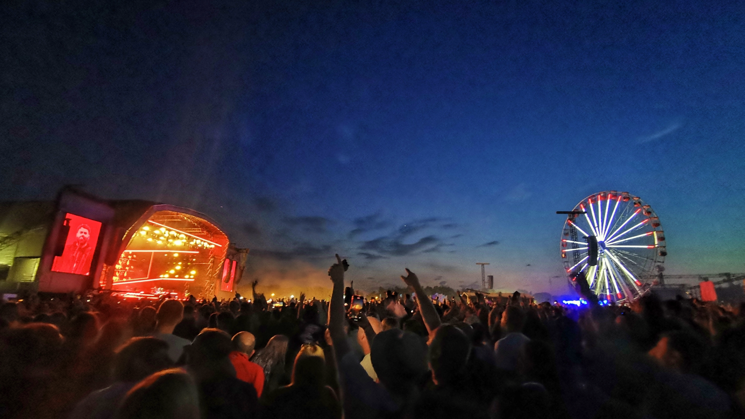
Manchester’s big wheel is returning to Exchange Square for the summer… sort of
Emily Sergeant
Manchester is set to reach new heights, as the big wheel that once stood proudly in the city centre is making a comeback this summer.
Well… sort of.
That’s because it’s not quite the same big wheel that many will remember from its glory days in locations like Piccadilly Gardens and Exchange Square throughout the 2000s, and more recently Albert Square during last year’s Manchester Christmas Markets – but it is a big wheel and it’s a big wheel that you’ll be able to hop on for a ride.
Celebrating the launch of its new Cloud Frappuccino blended drinks range, Starbucks’ Summer in the Clouds arrives in Exchange Square next Friday and Saturday (24 and 25 July), inviting people to escape the hustle and bustle and enjoy panoramic views of the city below from a big Ferris wheel.
The two-day takeover will give customers the chance to unlock a ride on the big wheel with the purchase of any Grande or Venti iced drink from participating Manchester city centre Starbucks stores.
Both in participating stores – which in Manchester are Starbucks stores in the Arndale, City Tower Offices, on Market Street and on Fennel Street – and at the Ferris wheel itself in Exchange Square, you can expect complimentary Cloud Frappuccino-inspired candy floss, live music from DJ and presenter Ethan Porte, and a free photobooth with digital and printed photos.
Alongside the big wheel ride, there’ll also be the chance for members to win exclusive Starbucks merchandise across the two days too.
A limited number of additional ferris wheel ride tokens will also be available to win via the fairground-style Plinko game on site.
The new Starbucks Cloud Frappuccino blended drinks range includes a range of bespoke creations like the Strawberry Matcha Cloud Frappuccino, the Brown Sugar Cloud Frappuccino, and the Caramel Mocha Cloud Frappuccino.
With skyline views and summer sips, Starbucks says its Summer in the Clouds is set to be one of Manchester’s must-visit experiences this month.
Starbucks’ Summer in the Clouds arrives in Exchange Square next Friday 24 and Saturday 25 July.
Featured Image – Cédric Dhaenens (via Unsplash)
Trending
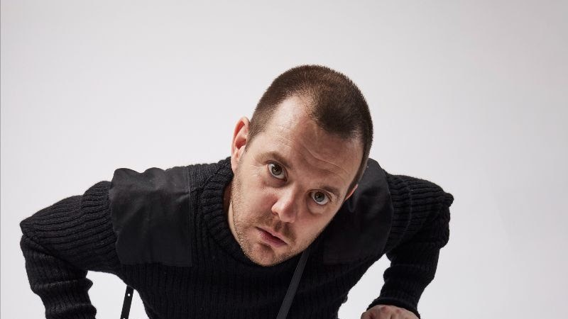
Liam Fray says ‘yes’ to Courteeners supporting Oasis on tour amid rumoured 2027 dates
Danny Jones
Liam Fray has said that the Courteeners are ready to “answer the call” if/when it comes to supporting Oasis on their next big live tour, with rumours of dates for shows in 2027 ramping up.
The fellow Manc favourites were heavily suggested as potential support acts for the Live ’25 reunion gigs, but Cast and Richard Ashcroft were ultimately selected as the warm-ups for the world tour.
With that in mind, when asked if Courteeners would be ready to open up for Oasis on their still only hypothetical tour next year, Fray had a very quick answer:
Not to speak for the Middleton musician, but it’s a bit of a no-brainer, really.
As you can see, in a recent interview with Radio X host Johnny Vaughan promoting the indie rockers’ new single, ‘Plus One Forever’, the 41-year-old frontman made it clear that he and his bandmates would bite hands off if the other Liam and/or his brother Noel offered a slot to them.
The younger Gallagher brother definitely had plenty of fun teasing supports last time around, before making some fairly more obvious posts and then seemingly just announcing them on social media according to his own timeline.
LG does what he wants, after all.
As for the supposed ’12 nights at the Etihad Stadium’ reported recently, not to mention all the other sets across the country that would no doubt follow should they come to fruition, Fray could say little else other than simply “Yes” to the prospect.
Joking, “Well, it is from me – I don’t know if someone else has said no!”, there have been no other indications on this front, but it’s safe to say it’d be a huge booking for everyone involved and a HUGE crowd-pleaser; Liam looks to be working on one of his own, elsewhere, too…
The two lead singers have both graced the stage of the Emirates Old Trafford stadium at Lancashire County Cricket Club, as well as Heaton Park, respectively.
Liam noted that he was at Heaton Park himself for that unforgettable summer last year, and also praised Wigan’s very own Ashcroft for being “unbelievable” when he caught him at Wembley. Big shoes to fill. The question is, who would you like to see supporting Oasis on their possible tour dates in the future?
In the meantime, we’ll have to be satisfied with gearing up for the release of the highly-anticipated reunion documentary, with the title and a first trailer now revealed.