Trending
Greater Manchester could see snow this week as Met Office issues yellow weather warning
It's about to get a whole lot chillier.

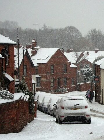
Greater Manchester could be set to see snow once again this week, as the Met Office has issued a yellow weather warning.
Weather forecasters are predicting that cold air from the north will see temperatures plummet for many across the UK this week, and for some, this will bring with it an “increased chance of wintry hazards” and even a sprinkling of snow.
While it’s been a typically rainy and windy morning for Greater Manchester so far today, that is expected to clear to the south tomorrow (Wednesday) and leave us with a “largely drier” day.
However, with the UK “under the influence” of arctic air, this does mean it’ll be much colder and below average for the time of year.
According to the Met Office, there’ll be an “ongoing chance” of ice overnight throughout the week.
A yellow weather warning for snow – which covers northern and central England, as well as much of Wales – has been issued, and it comes into place from Thursday with an “increased chance” of snow expected in some parts of the UK until the end of the day on Friday.
Chris Almond, who is the Deputy Chief Meteorologist at the Met Office, assures it’s only from Thursday that the risk of snow becomes “more potentially impactful”.


He explained: “While the early part of this week will see some rain, at times heavy, gradually sinking southwards, there’s an increased signal for wintry hazards as we move through the week as cold air from the north moves over the UK.
“It’s from Thursday that the snow risk becomes more potentially impactful, as mild air attempts to move back in from the south, bumping into the cold air and increasing the chance of snow developing on the leading edge.”
Mr Almond said there’s “still lots of details” for the Met Office to work out when it comes to the chance of snow across the UK.
He admitted that it’s likely weather warnings will be amended and updated throughout the week.
The initial snow risk looks the “highest” in northern England, with a possible 1-2cm in low levels, and even 10-20cm possible over high ground.
“This snow will likely gradually transition to sleet and rain later on from the south,” Mr Almond concluded.
Read more:
- Greater Manchester wakes up under thick blanket of snow
- The Council wants to widen pavements and reduce road width on these major Manchester city centre streets
- Met Office explains ‘supercell thunderstorm’ weather phenomenon that hit Stalybridge
Keep up to date with the yellow weather warning covering Greater Manchester here.
Featured Image – Benjamin Elliott (via Unsplash)


