UK News
Rare red weather warning issued in UK as Storm Eunice arrives

The UK is braced for the impact of Storm Eunice today, with a rare red weather alert issued by the Met Office.
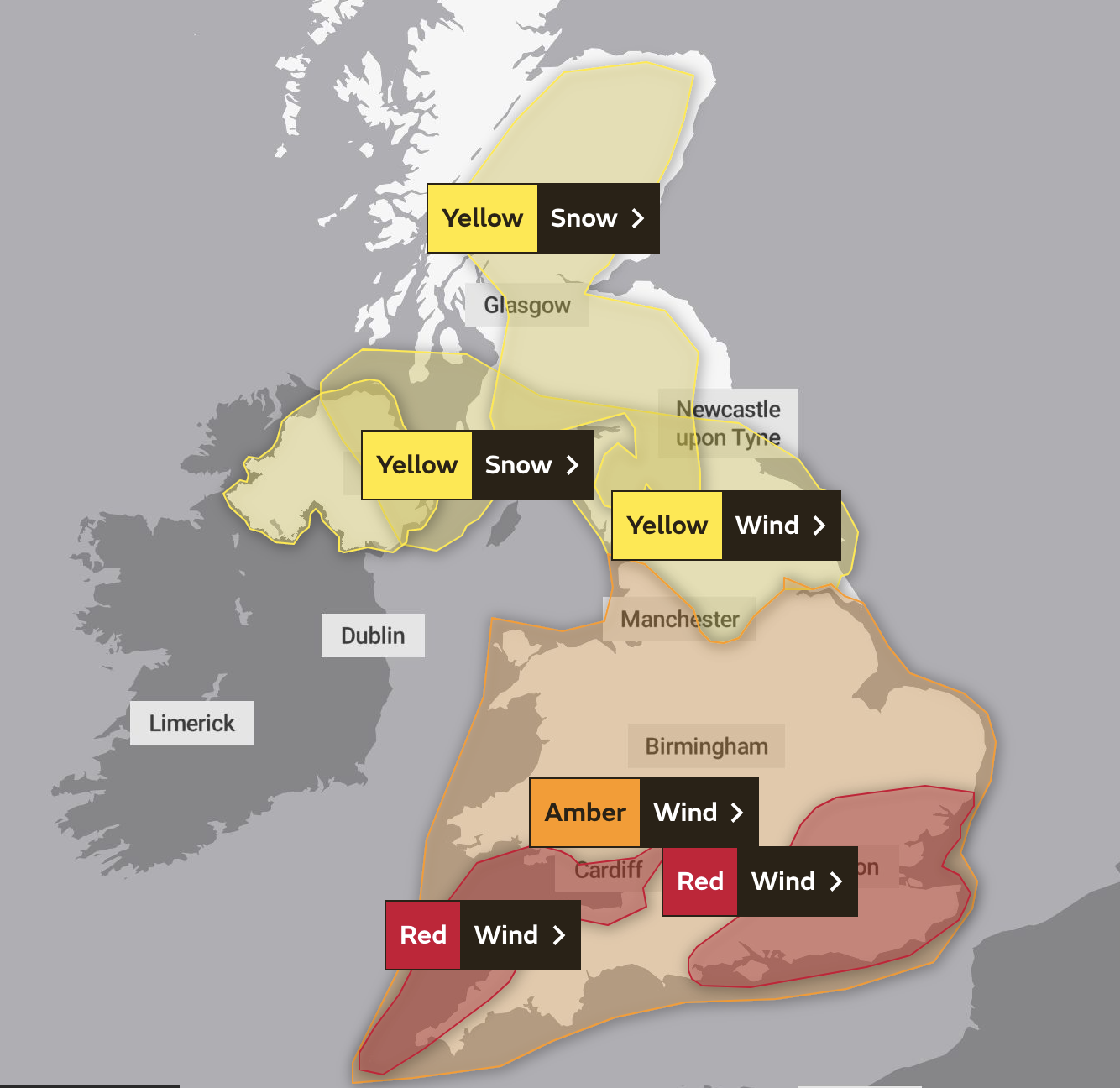
Several parts of the UK, including London, are now under a red warning – the highest possible level.
Extremely strong winds and widespread disruption are expected for most of Friday, with TfGM urging people to avoid travel.
In Greater Manchester, an amber weather warning is in place, which means there is ‘a good chance that flying debris could result in a danger to life’.
It also means that damage to buildings is likely, power lines may be brought down, and roads, bridges and railway lines are likely to close.

The amber alert is in place until 9pm.
There’s a 90% chance of heavy rain between 11am and 3pm and wind gusts of up to 57mph are forecast this afternoon.
Storm Eunice is expected to be much stronger than Storm Dudley, which hit the nation earlier this week.
A statement from TfGM says: “Storm Eunice is likely to cause significant disruption due to extremely strong winds today across the region between 5am – 9pm.

“Please consider whether your journey is essential today and take care if you are out and about.”
Meanwhile CrossCountry Trains has said: “Do Not Travel today. We are running a severely reduced and amended service, please do not travel today.”
Read more: How and why are storms named, and what will the next ones be called?
Met Office forecaster Annie Shuttleworth said: “The whole of the country will be affected by the extremely strong and damaging winds, which will cause significant disruption.
“People will see significant delays to travel and power cuts, so you should avoid travelling if you can and stay at home when winds reach the highest speeds.
“In areas covered by the red warning, especially coastal regions, there is likely to be overtopping of the sea, flooding to roads and homes, trees being overturned, tiles coming off buildings and power lines being toppled over.”
Featured image: Unsplash


